Abstract
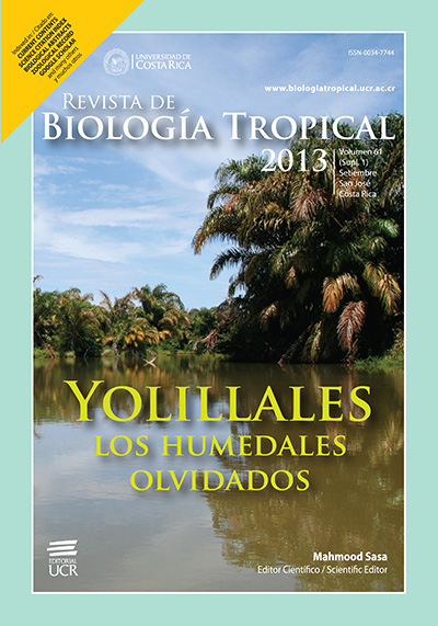
In Central America, palm swamps are known collectively as yolillales. These wetlands are usually dominated by the raffia palm Raphia taedigera, but also by the royal palm Manicaria saccifera and –in lower extensions– by the American oil palm Elaeis oleifera. The yolillales tend to be poor in woody species and are characteristic of regions with high rainfall and extensive hydroperiods, so they remain flooded most of the year. The dominance of large raffia palm leaves in the canopy, allow these environments to be distinguishable in aerial photographs, which consequently has helped to map them along most of their distribution. However, while maps depicting yolillales are available, the extent of their surface area, perimeter and connectivity remains poorly understood. This is particularly true for yolillales in Costa Rica and Nicaragua, countries that share a good proportion of palm dominated swaps in the Rio San Juan Basin. In addition, it is not known the actual area of these environments that is under any category of protection according to the conservation systems of both countries. As a first step to catalog yolillal wetlands in Costa Rica and Nicaragua, this paper evaluates cartographic maps to delineate yolillales in the region. A subsample of yolillales mapped in this study were visited and we geo-referenced them and evaluate the extent and condition of the swamp. A total of 110 883.2ha are classified as yolillales in Nicaragua, equivalent to 22% of wetland surface area recorded for that country (excluding the Cocibolca and Xolotán Lakes). In Costa Rica, 53 931.3ha are covered by these palm dominated swamps, which represent 16.24% of the total surface area covered by wetlands. About 47% of the area covered by yolillales in Nicaragua is under some category of protection, the largest extensions protected by Cerro Silva, Laguna Tale Sulumas and Indio Maíz Nature Reserves. In Costa Rica, 55.5% of the area covered by yolillal is located within protected areas, mainly the Tortuguero National Park, Barra del Colorado Wildlife Refuge and the Sierpe-Térraba National Wetland. Therefore, in both countries, about half the area covered by these wetlands is not protected by their systems of protection of wilderness areas.
References
Calvo-Gutiérrez, C. M., F. Bonilla-Murillo & M. Sasa. 2013. Uso y conservación de humedales de yolillo Raphia taedigera (Arecaceae) en el Area de Conservación Tortuguero, Costa Rica. Rev. Biol. Trop. 61 (Supl. 1): 163-178.
Córdoba-Muñoz, R., J.C. Romero-Araya & N.J. Windevoxhel-Lora. 1998. Inventario de los humedales de Costa Rica. UICN/MINAE/SINAC/Embajada Real de los Países Bajos, San José, Costa Rica.
Espinal, L. & E. Montenegro. 1963. Formaciones vegetales de Colombia: Memoria explicativa sobre el mapa ecológico. Instituto Geográfico Augustín Codazze, Bogotá, Colombia.
Mejía-Lacayo, J. 2012. Humedales y aves acuáticas. Revista de Temas Nicaragüenses 46: 9-19.
Myers, R.L. 1981. The ecology of low diversity palm swamps near Tortuguero, Costa Rica. Ph.D. Thesis, University of Florida, Miami, Florida.
Myers, R.L. 1990. Palm swamps, p. 267-286. In A.E. Lugo, M. Brinson & S. Brown (eds.). Forested wetlands. Elsevier Science, Amsterdam, Holland.
Myers, R.L. 2013. Humedales dominados por palmas (Arecaceae), con énfasis en aquellos distribuidos en Costa Rica y Nicaragua. Rev. Biol. Trop. 61 (Supl. 1): 5-24.
Piedra-Castro, L. & J. Bravo. 2002. Refugio Nacional de Vida Silvestre Limoncito (RNVSL): Restauración y manejo de bosques inundables de palma (Raphia taedigera) y cativo (Priora copaifera). Programa Humedales de Costa Rica: Uso y Conservación, Universidad Nacional de Costa Rica, Heredia, Costa Rica.
Roth, L.C. 1992. Hurricanes and mangrove regeneration: Effects of hurricane Joan, October 1988, on the vegetation of Isla del Venado, Bluefields, Nicaragua. Biotropica 24: 375-384.
Sylvander, R. B. 1981. Los bosques del país y su distribución por provincia. EUNED, San José, Costa Rica. 121 pp.
Vandermeer, J., M.A. Mallona, D. Boucher, K. Yih, & I. Perfecto. 1995. Three years of ingrowth following catastrophic hurrican damage on the Caribbean coast of Nicaragua: Evidence in Support of the Direct Regeneration Hypothesis. J. Trop. Ecol. 11: 465-471.
##plugins.facebook.comentarios##

This work is licensed under a Creative Commons Attribution 4.0 International License.
Copyright (c) 2013 Revista de Biología Tropical


